No Injuries Reported as Firefighters Contain Blaze
March 14, 2025 – Garden City, MI
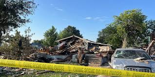
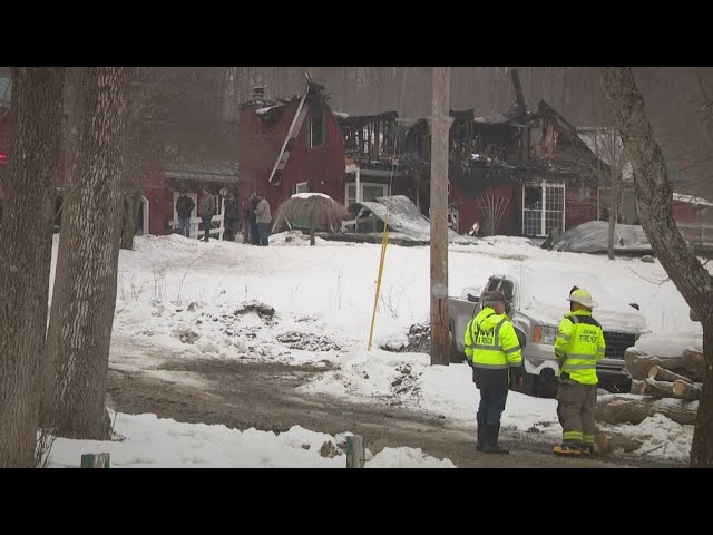
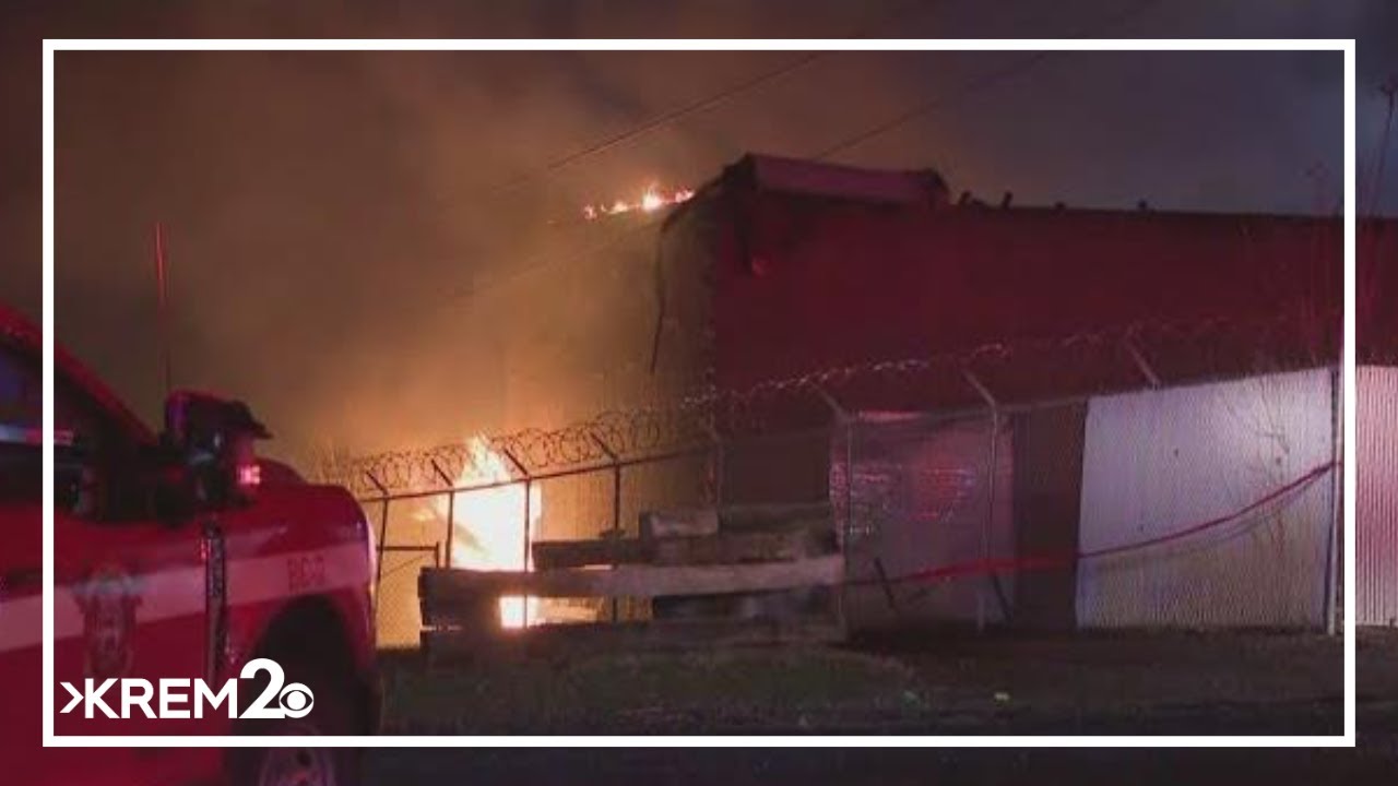
Authorities are investigating a house explosion that occurred Thursday evening in Garden City, sending thick black smoke into the air and prompting a swift response from emergency crews.
Explosion Rocks Neighborhood
At approximately 6:20 p.m., Garden City firefighters received reports of a possible house explosion in the 6500 block of Silvio Street. Upon arrival, crews found a single-story home engulfed in flames, with dark smoke pouring from the structure, according to Garden City Fire Chief Randy Keen.
One neighbor informed authorities that a single occupant resided in the home, but after a thorough search, firefighters confirmed that no one was inside at the time of the explosion.
Firefighters worked quickly to bring the fire under control, fully extinguishing the flames and several lingering hot spots by 7:20 p.m.
Investigation Underway
The cause of the explosion remains undetermined as authorities continue their investigation. DTE Energy crews responded to the scene and shut off the home’s gas service as a precaution. However, DTE spokesperson Chris Lamphear declined to speculate on whether a gas leak played a role in the incident, deferring to fire and police officials for further analysis.
“At this time, we’re looking into the cause and origin of the fire because, obviously, homes just don’t explode on their own,” Chief Keen stated.
No Injuries or Structural Damage to Nearby Homes
Fortunately, no injuries were reported among residents or emergency personnel. Chief Keen also confirmed that the explosion did not cause damage to any neighboring homes.
As officials work to determine what triggered the blast, residents in the area remain on alert while authorities urge anyone with relevant information to come forward.
Firefighters were forced to evacuate due to failing structural integrity, Portland fire officials said.
Credit: Gillian Graham Portland Press Herald, Maine
Mar. 6—One person died and four others were injured in a fire in Portland early Thursday morning.
Five adults who lived in the house at 11 Olympia St. were all inside when the fire was reported at 1:14 a.m. Four people were taken to Maine Medical Center, including one person who is in serious condition, according to fire Chief Chad Johnston.
The name of the person who died has not been released by fire officials.
The outside of the one-and-a-half-story, single family home appeared charred Thursday morning, with blown-out windows and damage to the roof and siding.
Responding crews were forced to evacuate the building due to intense fire conditions and failing structural integrity, said department spokesperson Sean Donaghue. Two firefighters were also injured in the fire but were not taken to the hospital, Donaghue said.
The fire was brought under control around 4:15 a.m. Nearby Veranda Street was closed for several hours overnight but reopened before the morning commute. Olympia Street remains closed, according to the fire department.
A team of investigators from the state fire marshal’s office are expected to be on scene throughout the day investigating the circumstances of the fire, said Shannon Moss, spokesperson for the Maine Department of Public Safety.
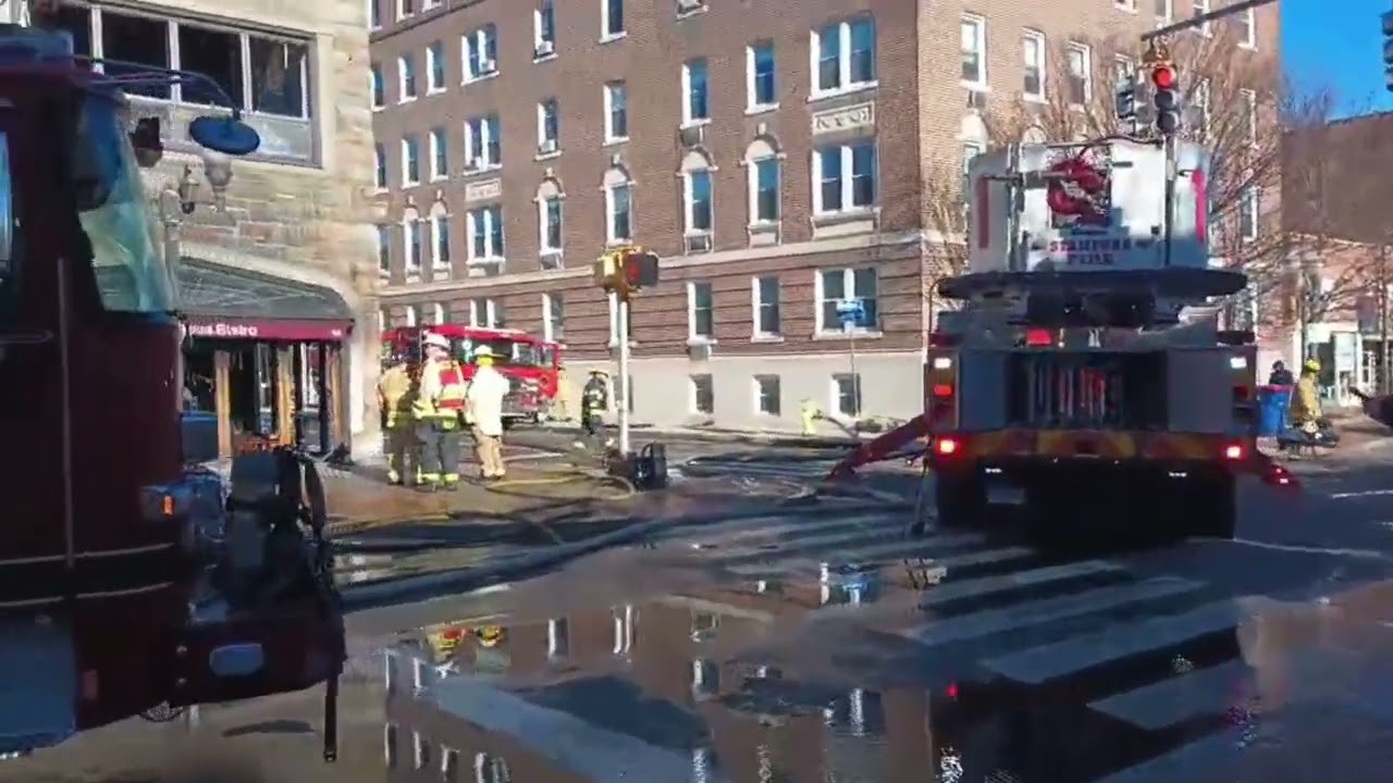
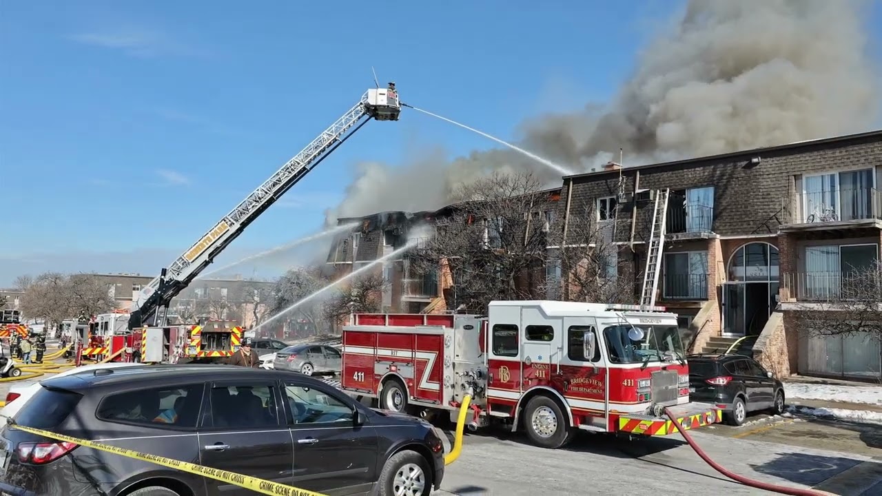
A four-alarm fire in Stamford is believed to have started in a restaurant and spread to other businesses during a two-hour fire fight.
Credit: Peter Yankowski, Kalleen Rose Ozanic, Tyler Fedor, Liz Hardaway The Hour, Norwalk, Conn.
Mar. 7—STAMFORD — A “devastating” four-alarm fire tore through a stretch of four businesses on the northern end of the Bedford Street block between Broad and Spring streets early Friday, according to Mayor Caroline Simmons.
At about 4:46 a.m. the Stamford Fire Department was dispatched to Bedford Street for an activated fire alarm. At the scene, firefighters saw smoke coming from the first floor of Chez Vous Bistro, a French restaurant on that corner, said Deputy Fire Chief Paul Newman.
The Fire Department sent 52 personnel, eight engines, three trucks, one heavy rescue vehicle and two command vehicles to battle the blaze, according to Assistant Chief Mike Robles.
Two firefighters suffered minor injuries. They were treated and released from a medical evaluation, Newman said.
About five hours after the fire, dozens of police officers and firefighters milled about the corner of Bedford and Spring streets, which was cordoned off with a wide police line that spanned multiple storefronts and around the intersection’s west corner.
Many of the windows at the now-blackened Chez Vous Bistro were charred and burnt out from the structure fire, the department reported on social media. Venetian blinds hung lopsided, tattered and melted in the window frames, their glass littering the ground below, as Stamford Downtown Ambassadors, decked in orange high-visibility jackets, picked up the pieces and swept the thousands of shards that covered the sidewalk.
Broken glass littered the ground in front of Atelier Valoar Couture, a bespoke dressmaking, alteration and tailoring business; its storefront display, filled Thursday with gossamer gowns and accessories, was in disarray Friday morning. Its interior, charred and coated in soot, was visible from the across the street.
Those two businesses, as well as the Women’s Business Development Council and Shiro, a pastry and dessert shop, were affected by the fire, Simmons said.
Newman said a large amount of fire was found in the walls and ceiling of the restaurant, eventually extending to the second floor, roof and other businesses on the first floor. The fire was declared under control at 6:51 a.m.
“This is probably one of the worst, most devastating fires we’ve had in downtown Stamford affecting multiple businesses in recent years,” Simmons said in front of Hop and Vine, a nearby bar and restaurant out of which emergency services operated Friday morning. “It’s heartbreaking for these small-business owners that they woke up and everything was damaged in their small business, so we are heartbroken for them and here to provide any support we can from the city side.”
There were no injuries reported among civilians, Simmons said.
Police closed off several streets in the downtown area to traffic as firefighters battled the blaze in the 180 block of Bedford Street, Stamford Deputy Fire Chief Matt Palmer said.
By 11 a.m., the scene was still closed off as dozens of first responders and emergency services filled the area. Crews were also called in for mutual aid from Greenwich and Norwalk, Palmer said.
Several roads were closed in the area, the Stamford Police Department social media post said. Those included Bedford Street at Broad and Spring streets, Summer Street at Spring Street and Forest Street at Greyrock Place.
The road closures were to remain in place likely until noon, the post said, adding that CT Transit bus service, as well as the First Student Bus Co., had been notified.
The Stamford Fire Marshal’s Office is investigating the cause and origin of the fire.
This is a developing story and will be updated as more information becomes available.
D.C. Firefighters Recall Harrowing Response to Deadly Plane and Helicopter Crash
WASHINGTON, D.C. — First responders who rushed to the devastating collision between an American Airlines jet and a U.S. Army Black Hawk helicopter over the Potomac River described the scene as overwhelming and unlike anything they had ever encountered.
D.C. Fire and EMS marine pilot CJ Isbell, who was among the first to arrive, called the experience “a nightmare.”
“With years on the job, you think you’ve seen it all, but that night was beyond anything I could have imagined,” Isbell told NBC Washington. “The scale of it—the number of victims, the debris, the sheer devastation—it was like something out of a movie, not real life.”
The collision, which occurred on January 29 as the American Airlines flight prepared to land at Ronald Reagan Washington National Airport, sent both aircraft plunging into the river, claiming 67 lives.
A Chaotic and Overwhelming Scene
Firefighter and EMS diver Steve Hater, who also responded to the crash, recalled the difficulty of processing the destruction.
“No matter how much experience you have, nothing prepares you for something like that,” Hater said.
Isbell and his crew were alerted by a phone call and immediately deployed their fireboat, reaching the crash site in under ten minutes. Despite having night vision and thermal imaging equipment, they struggled to see through the darkness. Instead, the strong odor of jet fuel told them they were close.
“As we approached, we saw part of the fuselage sticking out of the water, a massive debris field, and a thick layer of jet fuel covering the surface,” Isbell explained. “Our first priority was to check for survivors, so we began searching inside the fuselage, hoping to find anyone still alive.”
Hater noted that while visibility in the water was unusually clear due to the cold temperatures, making sense of what they saw was difficult.
“It was just wreckage everywhere, a tangled mess,” he said. “It took a moment to even comprehend what we were looking at.”
Coping with the Aftermath
Both first responders acknowledged that the tragic events of that night left a lasting impact. They continue to process the emotional toll of the experience with the support of colleagues and loved ones.
“I’ve leaned on my family and my fellow firefighters,” Hater shared. “Talking about it—just being able to be open with the people who were there—that’s helped the most.”
As investigations into the crash continue, those who responded remain focused on healing while honoring the lives lost in the tragedy.
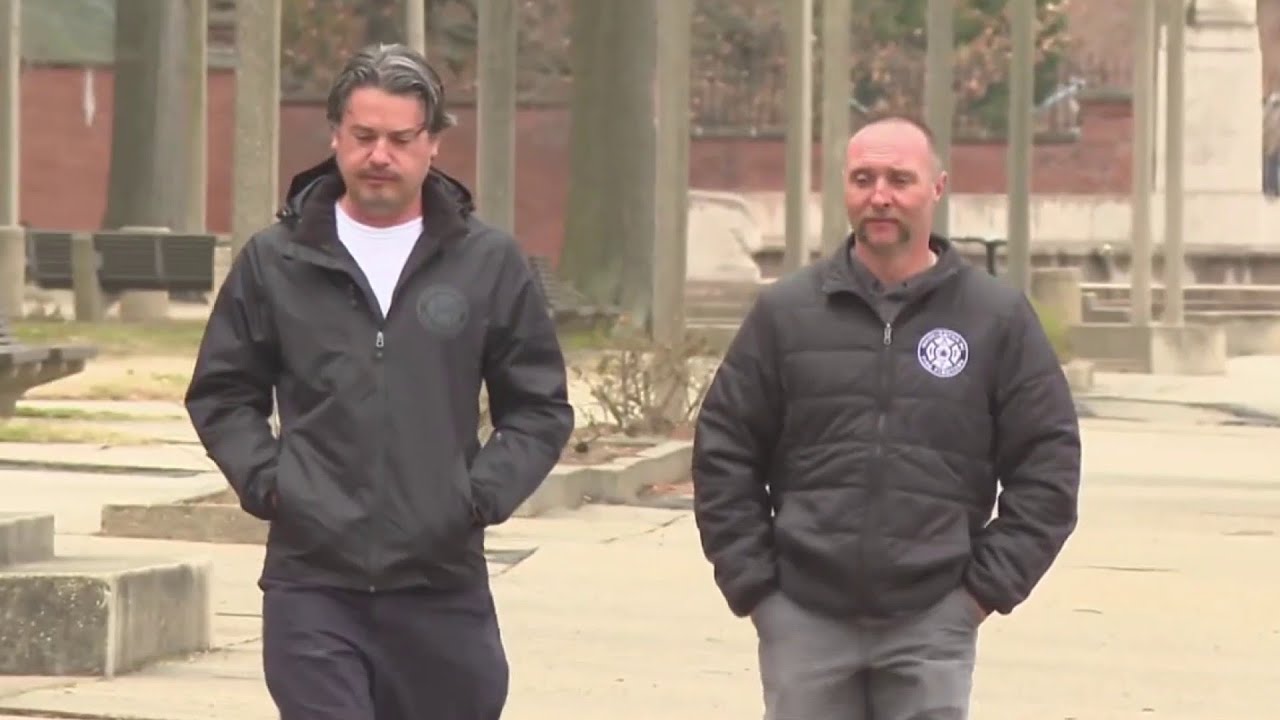
A MayDay call resulted in the firefighters being sent to the hospital for medical attention.
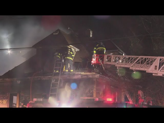
CUBA, N.Y. — A house fire in Cuba, New York, led to a mayday call on Sunday morning after the roof collapsed, injuring three firefighters. Emergency crews from Allegany and Cattaraugus counties responded to the blaze on Yankee Road shortly before 9 a.m.
According to Ischua Fire Chief Mark Kirtz, the fire had already spread extensively by the time firefighters arrived. “Flames were through the roof, and it was well involved,” Kirtz told WGRZ.
As crews worked to contain the fire, part of the roof gave way, prompting an emergency mayday call. Three firefighters sustained injuries and were transported to the hospital, though officials reported their injuries were not life-threatening.
The homeowners, Brenda Wyant and her husband, expressed gratitude for the firefighters’ efforts. “I was born on this road, and I’ll probably die on this road,” Wyant said. “I’m just grateful today wasn’t that day.”
Despite the devastating loss, one firefighter was able to retrieve a meaningful possession from the home. “He saw our family Bible sitting on the end table and brought it to me,” Wyant shared. “That means so much.”
Authorities continue to investigate the cause of the fire.
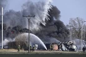
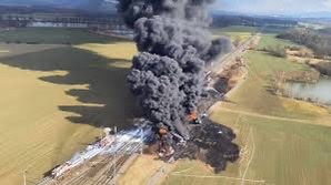
PRAGUE (AP) — Czech firefighters were battling a major chemical blaze in eastern Czech Republic on Friday after a freight train derailed and carcinogenic benzol from damaged tank wagons caught fire.
The derailment took place near the station in the town of Hustopeče nad Bečvou around noon local time (1100 GMT), with the fire sending thick black smoke into the air visible from a long distance. The cause of the derailment was under investigation. No one has been injured.
The nearest houses in the town are located about 500 meters (around a quarter-mile) from the fire, but the smoke hadn’t reached them.
Firefighters said that 15 of the 17 tanks in the train were on fire. Each tank contained about 60 metric tons (66 tons) of the toxic substance. They used a helicopter to contain the fire while their counterparts from neighboring Slovakia were on the way to help.
Authorities said that no levels of dangerous substances exceeding limits have been detected in the town, but advised that residents there and in nearby towns and villages don’t open their windows, and stay indoors.
Benzol contains benzene, toluene and xylene, which are used to make various chemical substances.
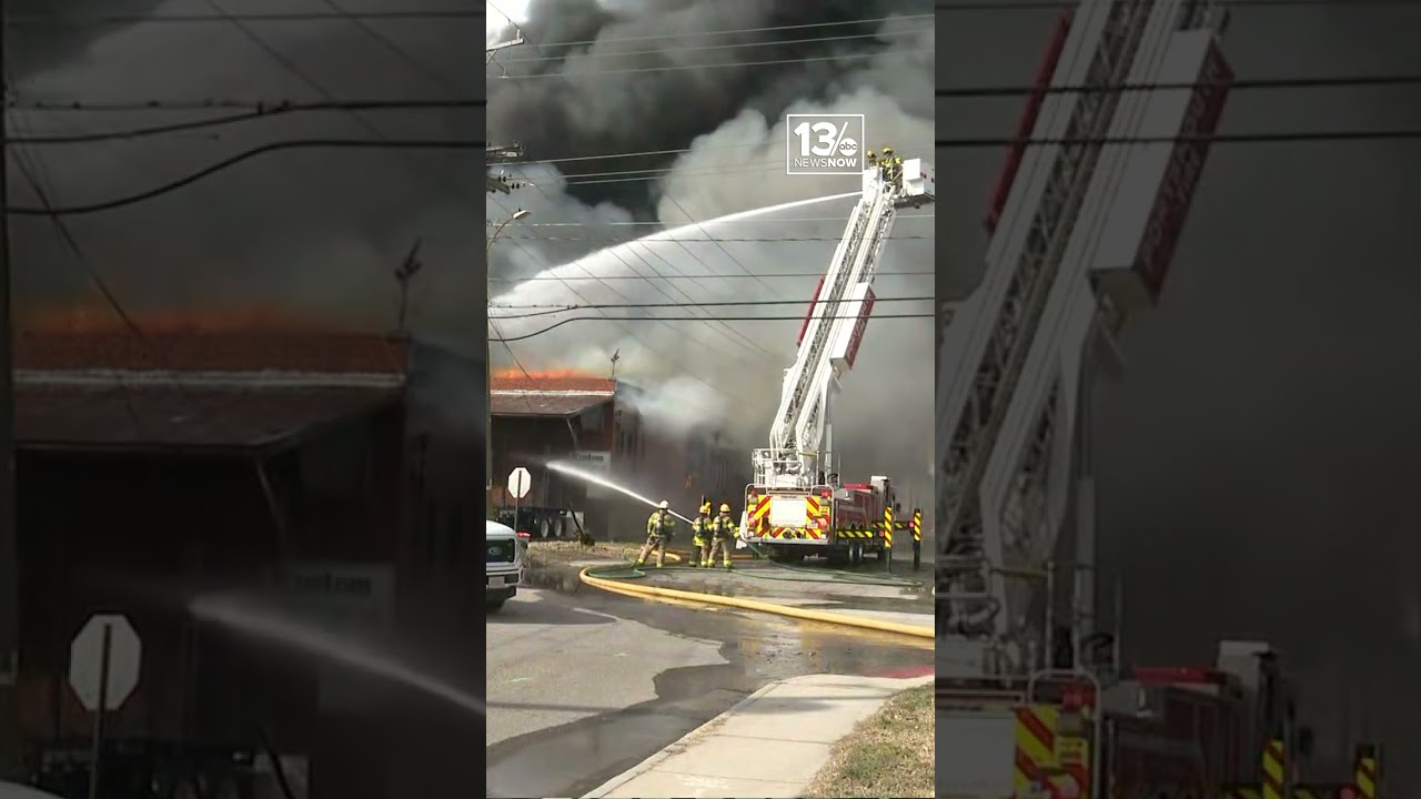
There are more than 80 firefighters involved in the operation that sent a plume of dark smoke over the Portsmouth area.
Eliza Noe
The Virginian-Pilot
(TNS)
A black plume of smoke rose over Portsmouth Wednesday morning after a fire started on the 900 block of Duke Street.
Multiple units responded to the fire at the warehouse, near the intersection of Interstate 264 and Effingham Street, when the call came in at about 9:30 a.m.
Battalion Chief Joseph Teartt of Portsmouth Fire and Rescue said about 80 personnel were on scene, and there are no reports of injuries for firefighters or civilians.
At this time, the cause of the fire is under investigation.
Researchers use models that combine how weather, topography and types of vegetation raise the risk that a fire will grow large and threaten neighborhoods.
Julie Johnson, Sriharsha Devulapalli San Francisco Chronicle
Feb. 25—With streaks of yellow, orange and red, Cal Fire’s new fire risk maps make plain the extent of fire danger in the Bay Area.
The origin of the maps date back to one of the first major wildfires to burn into neighborhoods in the state: the 1980 Panorama Fire in San Bernardino County. That fire triggered extensive research into which types of homes burned and which survived. Shake roofs made from wood shingles, for example, made homes especially vulnerable to flying embers.
Cal Fire’s maps, which are still in draft form, establish what the state calls fire hazard severity zones, which measure the likelihood of a major wildfire hitting certain areas and neighborhoods. State and local governments require homeowners to follow stricter building codes and landscape rules in some zones — such as banning more wood shake roofs in the riskiest areas.
What do these maps tell communities about fire risk?
Cal Fire’s maps characterize the threat of a potential fire that ignites in the wildland and comes into communities, said Dave Sapsis, a research manager with Cal Fire who was part of the technical team that developed the model.
They use models that combine how weather, topography and types of vegetation raise the risk that a fire, once ignited, will grow large and threaten neighborhoods. Steep terrain and eucalyptus trees, for example, add to fire risk.
But the maps have limits. They do not yet incorporate data for what happens once a wildfire becomes a true urban conflagration spreading from home to home, according to Sapsis.
“They’re modeling a buffer from the wildland to urban areas to account for ember cast,” he said.
He said that scientific models for urban conflagrations are still being developed.
The maps also aren’t meant to show that there is no risk from wildfires in areas not designated in a fire zone, and they focus on the heightened risk for places close to forests, grasslands, parks and other open spaces.
“The closer you are to that wildland edge, the higher the hazard is,” Sapsis said. “The more likely that wildfire that impinges will make it to you.”
Do Cal Fire’s maps require residents to make immediate changes to their properties?
No. Homeowners generally do not have to act until they make big changes, like when properties are built, renovated, purchased or sold. That’s when stricter building codes kick in requiring better roofs, fine mesh vents, multi-pane windows and fire-resistant siding to be installed.
Cal Fire provides a basic outline of the various codes.
The primary audience for the maps are city and county governments, and especially permitting departments, which inform residents about rules for the projects they undertake. For governments, the maps guide planning and development, and inform infrastructure requirements, such as those for roads.
But these zones could eventually impact a vast number of California yards.
The California Board of Forestry and Fire Protection is drafting new rules for the area within five feet of homes. The current plan is to ban most plants (apart from mature trees) and flammable materials like bark mulch and wood fencing within the five feet of residential structures. Studies have shown that embers that land in this area are less likely to set the home on fire if there isn’t material there to burn.
Called an ember-resistant zone, or “zone zero,” the rules would apply only in “very high” fire hazard severity zones in areas generally protected by local fire departments and in all areas listed on the maps as state responsibility protected by Cal Fire. Residents would not have to comply right away. Once adopted, zone zero requirements would first apply to newly built homes and then to existing properties three years after they are enacted.
Where did fire risk grow?
Some cities in the Bay Area gained more acres in the highest tiers of fire risk, including San Jose, Orinda and Half Moon Bay as well as counties including Sonoma and Napa, where multiple major wildfires have broken out in recent years.
In Sausalito, fire risk now extends nearly to the shoreline, according to Cal Fire’s map. The city has about 702 acres in one of the three fire hazard severity zones, whereas it had none listed in the earlier maps released between 2007 and 2011.
Marshall Nau, deputy fire marshal with the Southern Marin Fire Protection District, said the city’s steep terrain, dense neighborhoods and thick vegetation make it particularly fire-prone given the community’s proximity to wild open spaces.
The fire district considers fire risk to extend even further into the flatlands than Cal Fire’s maps show.
Nau said that he’s tried to reassure the many callers to the district who are more worried since the fires in Los Angeles. Residents can harden their homes in meaningful ways with fire-resistant materials and by clearing flammable brush away from structures, he said.
“We’re trying to bring the anxiety down so people can think clearly and take action,” Nau said.
What areas in the region show less fire risk?
Cities including Oakland, Berkeley, El Cerrito and Hillsborough have fewer acres designated in fire hazard severity zones.
In Berkeley, Cal Fire’s new modeling decreased the number of acres listed as having “very high” fire risk from 1,269 to 454. Some of those acres were spread into lower tiered categories, high and moderate.
Berkeley Fire Chief David Sprague said he was surprised to see homes along Panoramic Hill mostly designated as “moderate,” though the city considers this area to be at a major disadvantage should a wildfire ignite. The neighborhoods are densely packed on steep terrain with thick vegetation. Many of the homes are over 100 years old and weren’t made with modern fire-safe standards. Evacuation routes are very limited.
“Cleary, that’s not accurate,” Sprague said.
Cal Fire’s map is just a draft. Local jurisdictions will submit feedback and Cal Fire is expected to finalize the maps at some point later this year.
When will Cal Fire release the next batch of fire risk maps?
The maps released Monday covered cities and towns protected by local fire departments in 17 counties in the San Francisco Bay Area and along Northern California’s coast.
Cal Fire will release another batch of maps March 10 covering central California including Sacramento, and then a final group of maps covering Southern California will be published March 24.
Cal Fire published fire hazard severity zone maps for the areas of the state it protects , which includes most but not all of unincorporated California.
Firefighters entered the Hillyard plant but backed out when conditions were determined to be too dangerous.
Alexandra Duggan and Amanda Sullender
The Spokesman-Review, Spokane, Wash.
(TNS)
Feb. 25—A lithium battery factory was heavily damaged by fire Tuesday morning, temporarily forcing widespread evacuations in the Hillyard Neighborhood over environmental concerns.
A neighbor called 911 to report the fire at 4019 E. Central Ave. just after 4 a.m., said Spokane Fire Department spokesman Justin de Ruyter.
The business, MaxAmps Lithium Batteries, was founded in 2004 and assembles batteries for drones, vehicles and robotics, according to its website. The warehouse was built in 1993 and is owned by H&E Rental, which is based in Buckeye, Arizona, according to Spokane County property records. H&E bought the building in 2012.
Firefighters entered the building but backed out when it was determined conditions were too dangerous, de Ruyter said. The surrounding area was evacuated in the early morning, but by midday a perimeter had been set at the edge of the property.
It was the largest battery fire in Spokane, de Ruyter said.
Three residents in a home north of the building remain evacuated and may be displaced for several days as the residence is decontaminated. Nearby businesses remain unaffected, and de Ruyter said the Fire Department is “feeling pretty safe” regarding the possible health impacts to Hillyard residents close to the fire.
No injuries were reported related to the incident as of Tuesday afternoon.
Because of the chemicals involved in the battery fire, it is expected to continue smoldering for a day or two. The Fire Department will remain on-site to put out any flare-ups. The large flames observed in the early morning were in part caused by a damaged gas meter during the building’s partial collapse, causing an ignited gas leak.
The fire department’s equipment will have to be decontaminated, de Ruyter said.
Department of Ecology hazardous materials specialist Sean Thompson said it is a “blessing” that contamination hasn’t gone beyond the property. Water runoff is contained on the site, and air quality in the area does not seem to have been impacted, he said. But many questions remain over what kind of contamination can be caused by a lithium battery fire.
“What’s in the smoke? What’s in the fire? What is the contamination? All those things you would expect an answer to at a national level are not there,” Thompson said.
The cause of the fire is still under investigation.
Officials said the fire is a reminder to the public to dispose of lithium batteries found in electric devices at a transfer station rather than a trash can. Improperly disposed batteries can cause fires in garbage trucks and landfills. More information and a list of local transfer stations can be found at batterysmartspokane.com.
A Roberts Park fire chief said the roof of the three-story building collapse as firefighters battled the Justice fire.
Firefighters spent hours battling a fire that ripped through an apartment building in Justice Saturday morning.
The fire was reported on South 88th Terrace in a three-story building with a Mansard roof.
Roberts Park Fire Protection District Chief Jeffrey Ketchen told CBS News Chicago that firefighters found heavy fire on the top floor of the building when they arrived.
As firefighters poured water on the blaze, much of the building’s roof collapsed.
A resident told the television station that the apartment’s management would not allow the displaced residents to take shelter in their office.
“We were told we have to go to the police station for shelter. It’s very cold out here. I have a lot of things in my apartment, and I have lost everything,” Jaclin Jackson told CBS.